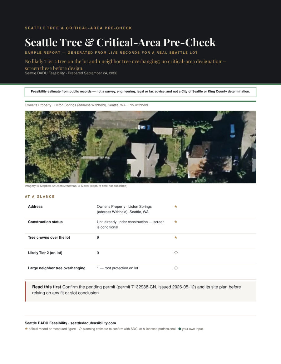
Seattle Tree & Critical-Area Pre-Check

Which trees and critical areas will block a project on your Seattle lot.

Before you pay $400–$1,200 for an arborist or thousands for a geotech, find out whether you even need one. This pre-check maps your tree crowns, estimates the likely protection tiers, flags any Environmentally Critical Areas, and tells you straight whether a professional is required.

$39 one-time · 12-page sample · In minutes

PDF by email in minutes · Stripe-secured · you confirm the matched parcel before you pay

Photo: Houses on Magnolia Bluff over Elliott Bay Marina, Seattle — Joe Mabel — CC BY-SA 4.0

Try it

Which tier is that tree?

Height is a proxy for the trunk (DSH) tier. Enter a tree's height to see the likely band and what it means for a DADU.

Get the full tree & critical-area screen

Inside this dossier

A 12-page sample, chapter by chapter.

The chapter index of your report — the real table of contents from the sample, rebuilt for your address at purchase.

  1. Cover1
  2. Report disclaimer2
  3. Your property from above4
  4. Executive summary5
  5. Tree verdict5
  6. Tree tier table6
  7. Per-tree screen6
  8. Critical-area verdict7
  9. Ground & hazard flags7
  10. Do you need a professional?8
  11. What would change this verdict8
  12. Worked examples from real Seattle lots9
  13. What to do next9
  14. Sources11
  15. Before you rely on this3
  16. Next step: the full study12

Sample pages

How it reads, page by page.

Tree & critical-area screen — three pages from the sample PDF, generated from a real Seattle address. Your copy is built from your own parcel.

Method & sources

Methodology: where every figure comes from.

Every figure follows the same methodology — live public records or a dated constant, marked ★ official or ◇ estimate.

  • Seattle tree canopy LiDAR 2021crown heights and radii, estimated tiers
  • SDCI Environmentally Critical Areas (SMC 25.09)steep slope, landslide, liquefaction, peat, flood, riparian and more
  • SDCI protected / inventoried tree recordsrecorded exceptional and heritage trees
  • Street tree inventorytrees in the right-of-way at your address

Worked examples

Real Seattle lots, run through this report.

Three Seattle addresses measured with the same engine, so you can see how the analysis lands on lots like yours.

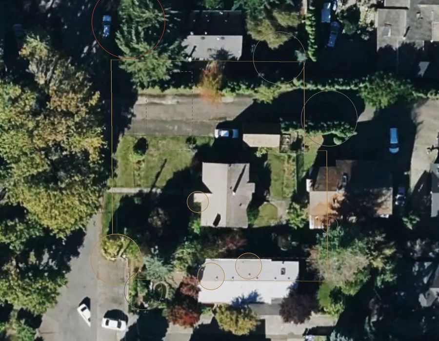
Licton Springs — 9 crowns — arborist likely
Aerial with the report's measured overlays drawn to scale.

Worked example 1 · Licton Springs

9 crowns — arborist likely

Tree crowns over the lot
9
Likely Tier 2 (on lot)
0
Critical-area designations
0
Canopy
23%
Arborist needed?
Likely

9 tree crowns over this Licton Springs lot, from the 2021 LiDAR survey, with no likely Tier 2 tree and no critical-area designation. Canopy covers about 23% of the lot. Because several crowns are large enough to sit in the regulated tiers, an arborist is indicated before siting a DADU — LiDAR height is only a proxy for the trunk measurement that sets the legal tier. With no ECA polygon, no geotech is indicated and the pre-approved path stays open. Confirm the tier on site with an arborist before paying for design.
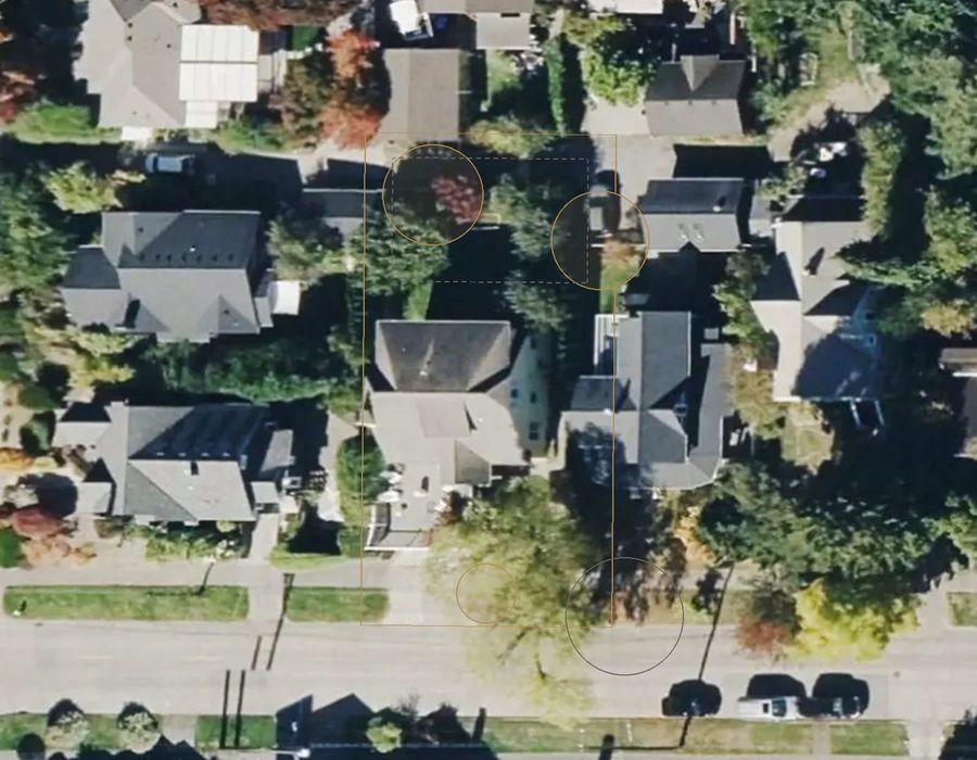
Ballard — 4 crowns — probably clear
Aerial with the report's measured overlays drawn to scale.

Worked example 2 · Ballard

4 crowns — probably clear

Tree crowns over the lot
4
Likely Tier 2 (on lot)
0
Critical-area designations
0
Canopy
33%
Arborist needed?
Probably not

4 tree crowns over this Ballard lot, none likely Tier 2, and no critical-area designation. Canopy covers about 33% of the lot. With no regulated-size tree near the likely footprint, an arborist is probably not needed and no geotech is indicated — the pre-approved path stays open. The catch is that LiDAR measures height, not trunk size, so a tree planted since 2021 would not appear and only an arborist's DSH measurement sets the legal tier. A boundary survey is still the first survey spend, before signing any design contract.

Ballard — No trees, no critical areas
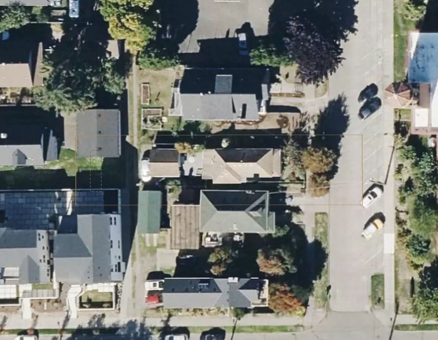
Aerial with the report's measured overlays drawn to scale.

Worked example 3 · Ballard

No trees, no critical areas

Tree crowns over the lot
0
Likely Tier 2 (on lot)
0
Critical-area designations
0
Canopy
4%
Arborist needed?
Probably not

Zero tree crowns over this Ballard lot in the 2021 LiDAR survey — canopy is about 4% — and no critical-area designation. With no trees to tier and no ECA polygon, an arborist is probably not needed and no geotech is indicated. That is the cleanest possible screen: a project here is unlikely to be blocked by trees or critical areas, so the pre-approved path stays open. The two caveats: a tree planted since 2021 would not appear in the LiDAR, and only an on-site check confirms it. A boundary survey is still required before setbacks are set.

Questions, answered

Before you order.

Do I need an arborist?

Only if a likely Tier 2 or larger tree sits near the planned footprint. The pre-check estimates the tier from LiDAR height — the legal tier is set by an arborist's trunk measurement, so the report tells you when that visit is actually worth paying for.

Is this a legal tier determination?

No. Tiers are estimated from LiDAR height alone, not a trunk (DSH) measurement. Only an ISA arborist's measurement sets the legal tier under SMC 25.11.

What happens if a critical area is flagged?

Any ECA removes the fast pre-approved permit path and typically triggers a geotechnical report. The pre-check tells you which designations hit your lot and what they mean before you commit.

Read first — free

The free Seattle guides behind this report.

Everything this report measures is explained for free first. Read the guide, decide whether you still want it measured for your own address.

Step 1 of 3

Tell us about your lot

Pay on Stripe at step 3
Photos of your house and yard Optional — up to 5, JPEG/PNG
  • Stripe-secured
  • Delivered in minutes

Need the full picture?

This report answers one question. The $149 Customized Feasibility Report covers zoning, setbacks, trees, critical areas, utilities, fees and a permit path — reviewed by a person before it reaches you.

Get the report — $39 All reports